General Information:
- Mount Rainier National Park was established on March 2, 1899, making it the fifth oldest park in the United States National Park system.
- The park encompasses 951 square kilometers (366 square miles) of the central Washington Cascades.
- The average elevation of the park is 1,577 m (5,172 ft) with a low of 522 m (1,712 ft) near the Carbon river and Ohanapecosh entrances, and a high of 4,392 m (14,410 ft) at Columbia Crest.
- The 260 kilometers (161 miles) of roads and more than 484 kilometers (300 miles) of trails provides visitors with ready access to several of the mountain's 25 glaciers.
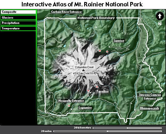
About this map:
This map is a shaded relief map created from digital elevation data produced by the U.S. Geological Survey. This data, called Digital Elevation Models (DEMs), are frequently used in computerized map making and glacier research.
Clicking on any one of the large red and white dots will access photographic panoramas taken at that location. To view these panaoramas you must have a Quicktime plug-in installed in your web browser. Plug-ins are available for both Windows and MacOS versions of Netscape Communicator and Internet Explorer at <http://www.apple.com/quicktime/download/>.