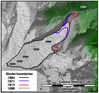

Viewing Emmons Glacier: To see Emmons Glacier, drive to the Sunrise Visitor's Center. Walk about 0.2 miles from the visitor's center to Emmons Vista. For a closer view of the glacier, walk approximately 1.2 kilometers (1 mile) from the trailhead at White River Campground to the Moraine Trail at the signed junction. The trail on top of the moraine gives you several excellent views of the terminus of the glacier. For experienced hikers, the trail continues across the rocky plain in front of the glacier and onto the glacier itself. |
General Information:
Emmons Glacier has the largest area of any glacier in the contiguous United States, although Carbon Glacier has a greater volume of ice. The glacier descends from the summit into the White River Valley. Much of its lower surface is covered with rock debris that originated from a December 1963 rock fall off Little Tahoma Peak on the glacier's south flank. The floor of White River Valley is covered with rocky debris, indicating that the terminus of Emmons Glacier during the Pleistocene was nearly 64 kilometers (40 miles) long. Moraines in the valley indicate that the glacier was nearly 300 meters (1000 feet) thick near White River Campground. Text adapted from A Visitor's Guide to Mt. Rainier Glaciers by Carolyn Driedger. |