|
 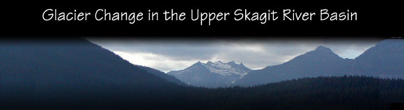
Welcome to the Glacier Change in the Upper Skagit River Basin Web Site
- by Frank D. Granshaw and Dr. Andrew G. Fountain
- Department of Geology
- Portland State University
- Portland, Oregon
- Funding provided by the Skagit Environmental Endowment Commission
- Assistance provided by Jon Riedel (North Cascades National Park), Jeffery Such (Skagit Provincial Park), Thomas Eng (BC Parks, Lower Mainland District)
-
-
What's so important about glacier change?
- Because of their small size, these glaciers are highly sensitive to changes in temperature and precipitation making them important indicators of climate change. (c)
- While small, mountain glaciers make up less than 3% of the earth's ice cover, they account for approximately 20 to 50% of the 10-15 centimeter rise in sea level over the last century. (c)
- Changes in the mass of these glaciers affect the volume and timing of stream flow that provide water for hydroelectric power production, irrigation, and domestic water supplies. (c)
- Changes in the size of alpine glaciers produce changes in the size and distribution of subalpine forests, meadows, and other high mountain ecological zones. (c)
Where is the Upper Skagit River Basin?
The Skagit River is located in Northwestern Washington State and Southwestern British Columbia. It begins in the North Cascades Range where its flows through rugged, glacially carved mountains. Then across broad coastal plans, and finally empties into the Puget Sound. The Upper Skagit River Basin includes the Skagit River watershed upstream from Seattle City Light's Ross Dam.
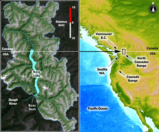
The extent and Location of the Upper Skagit River Basin
Questions, problems, or comments?
Address them to Frank Granshaw at <fgransha@artemis-science.com>
or Andrew Fountain at <bjaf@pdx.edu>
- This site last was created June 20, 2002
- last modified May 24,2003
|
|