

|
|
Natural Geography
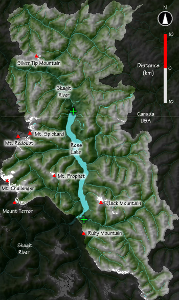
The Upper Skagit River Basin above Ross Dam includes 2628 km2 of the North Cascades Range. From a low point of 478 m, the basin climbs to over 2600 m and has an average elevation of 1438 m. Approximately 1% of the basin is covered by over eighty glaciers. What to do with this map Click on any of the green crosses on the map to see photographic panoramas taken from those locations. Note - To view these panaoramas you must have a Quicktime plug-in installed in your web browser. Plugins are available for both Windows and MacOS versions of Netscape Communicator and Internet Explorer at <http://www.apple.com/quicktime/download/ |
|
| .
|
||
