
|
|
Glaciers of the 20th century
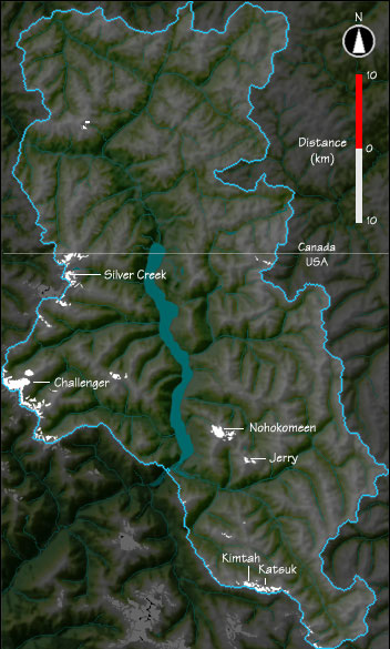
The Upper Skagit River Basin contains 84 glaciers having areas ranging from 0.1 to 3.4 km2. These glaciers have a combined area of 28 km2 (approximately 1% of the total basin area) and have an estimated total volume of 2.1 km3. Glacier change during the 20th century Much of what is known about glacier change in the Upper Skagit Basin is limited to the latter half of the 20th century. Using U.S. Geological Survey topographic maps and aerial photography from the 1950s and 1990s, changes in area and volume were determined for 84% of these glaciers (those within the North Cascades National Park Complex). Between 1958 and 1998 the combined area and volume of these glaciers decreased by nearly 8%. What to do with this map Click on any of the glaciers to see a more detailed map of it and its surroundings. |