RESEARCH
Working with Dr. Andrew Fountain, research goals involve providing a history of glacial fluctuations, dating back to the Pleistocene/Holocene boundary, in the Goat Rocks Wilderness, WA. Investigative methods occur primarily on lateral and terminal moraines as well as bogs and meadows and include lichenometry, tephrachronology, soil chronosequencing, and radiocarbon dating. From the collected and analyzed data, maps of glacier extents and a paleoclimate record since the late Pleistocene will be produced. Broadly, this research hopes to add to a continuously growing record of the relationships between alpine glaciers and their paleoclimates throughout western North America.
FIELD WORK
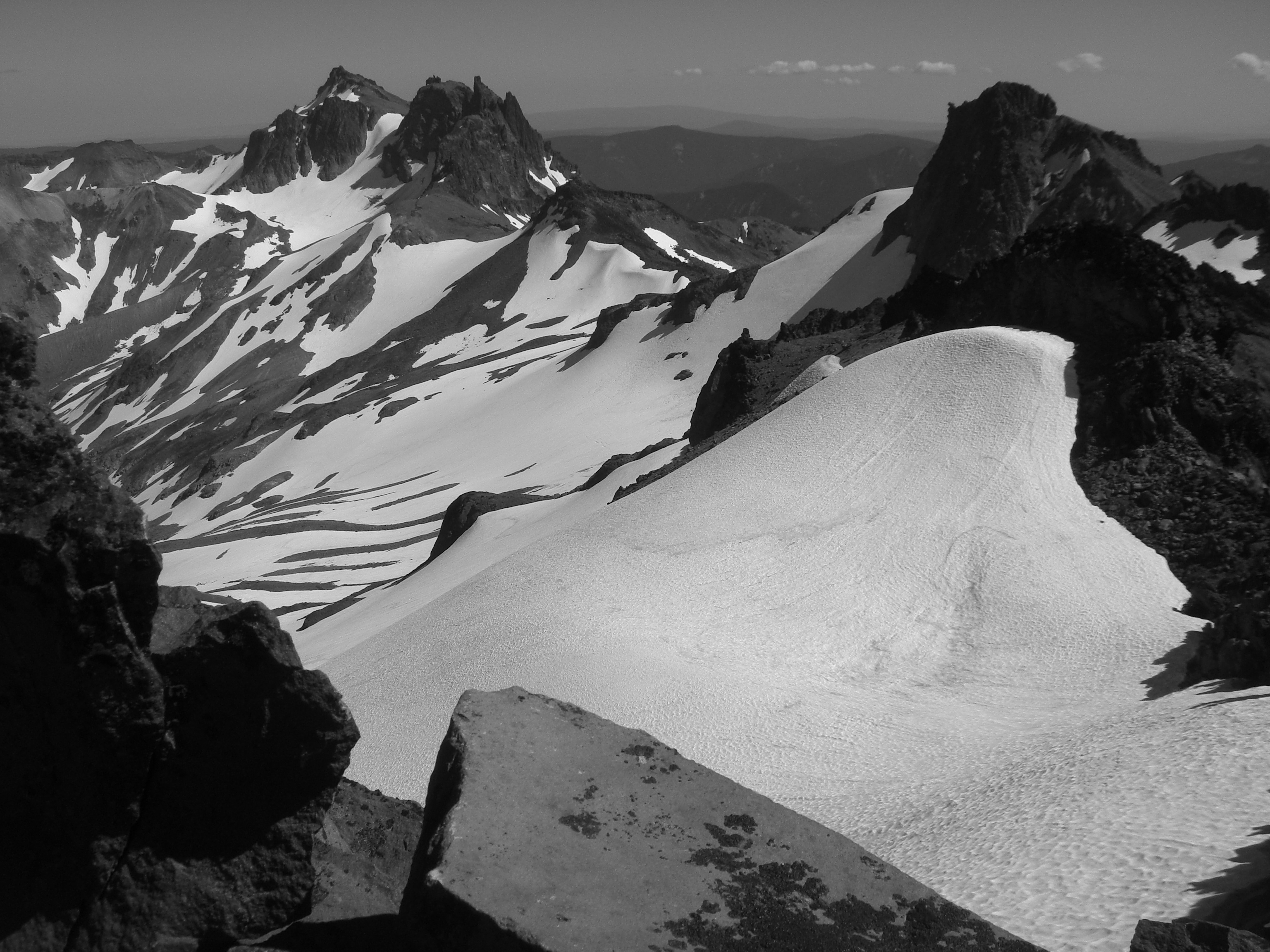
During the summer of 2009 I focused my attention on mapping the present locations of the small alpine glaciers that sit on the north/northeast sides of the Wildernesses highest peaks. This was accomplished by hiking the perimeters of the glaciers while collecting GPS coordinates along the way.
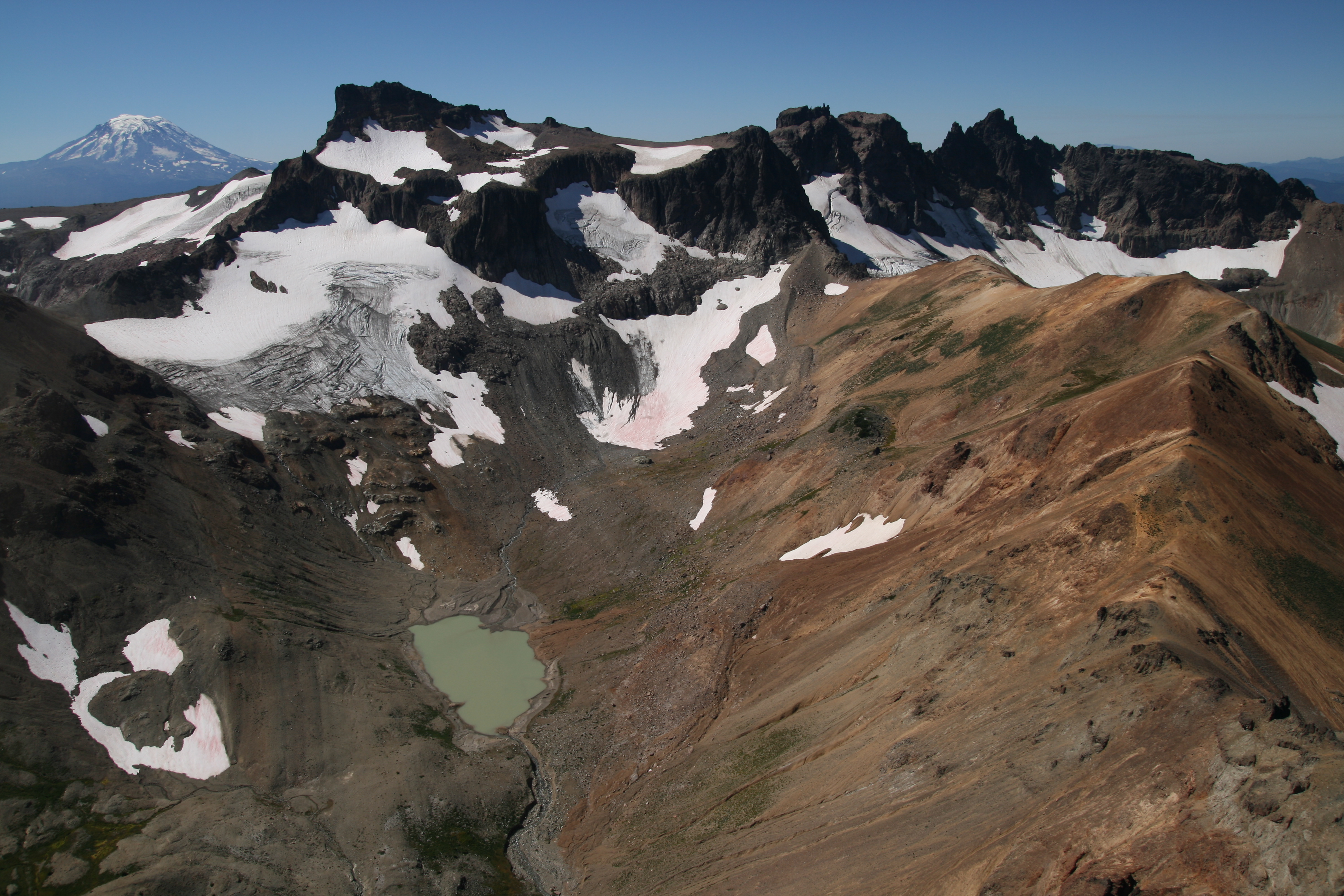
 Glacier edges that were too dangerous to reach were mapped using NAIP imagery (above) and aerial photos (courtesy of John Scurlock) from 2007. Below is a one of John's photos of Conrad Lake just below Conrad Glacier. Beautiful Mt. Adams in the background.
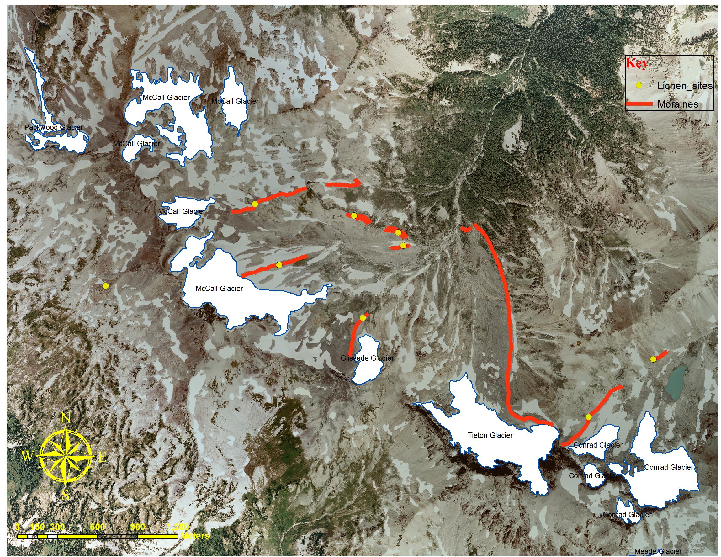
Digital raster graphics (DRGs) were used to compare the extents of the present-day Goat Rocks glaciers, that I mapped last summer, to the glacier extents on the DRG (see topographic map below). Since the glacier extents on the topo map were mapped in the middle of the 20th century, its possible to measure how much the glaciers have receded since that time.
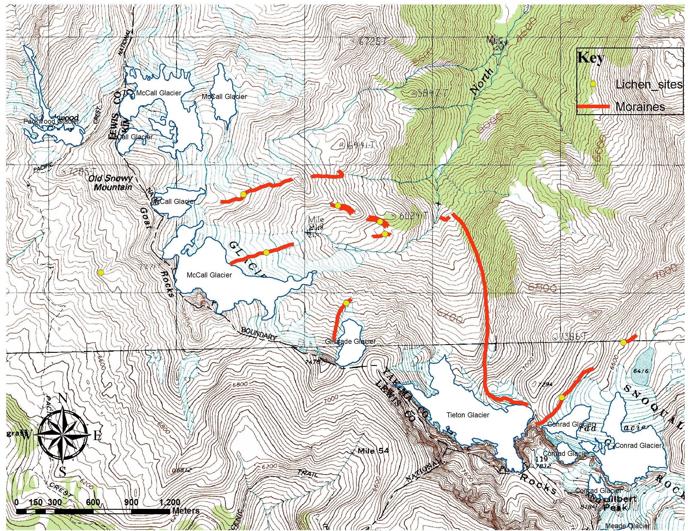
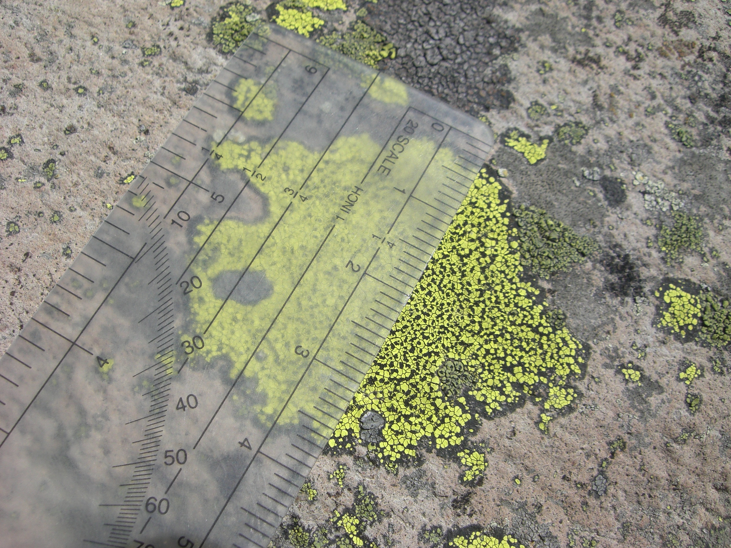
In addition to mapping the glacier extents, I also measured the size of lichen (Rhizocarbon geographicum) that were growing on glacial deposits. Since glacial deposits, like moraines, are deposited when the glaciers reach maximum positions, lichen, which begin growing soon after deposition, can provide accurate ages of the deposits (or the time when the glaciers were at a maximum size). Lichen dating is an accurate tool to use as far back as a few hundred years and, therefore, was used only on the youngest deposits such as those from the Little Ice Age (LIA). Some of the locations where I collected lichen measurements are shown in the maps above.
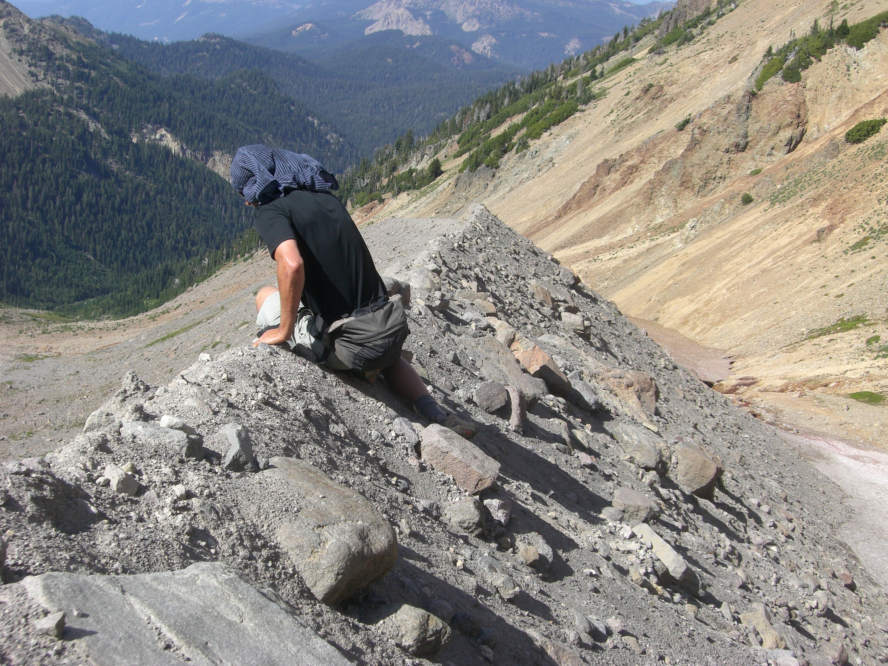
During the summer of 2010 I focused my attention on mapping moraines, of which, over 30 were mapped. Many of the mapped moraines, like the knife-ridged one below, are young. This is because not enough time has elapsed for them to erode away.
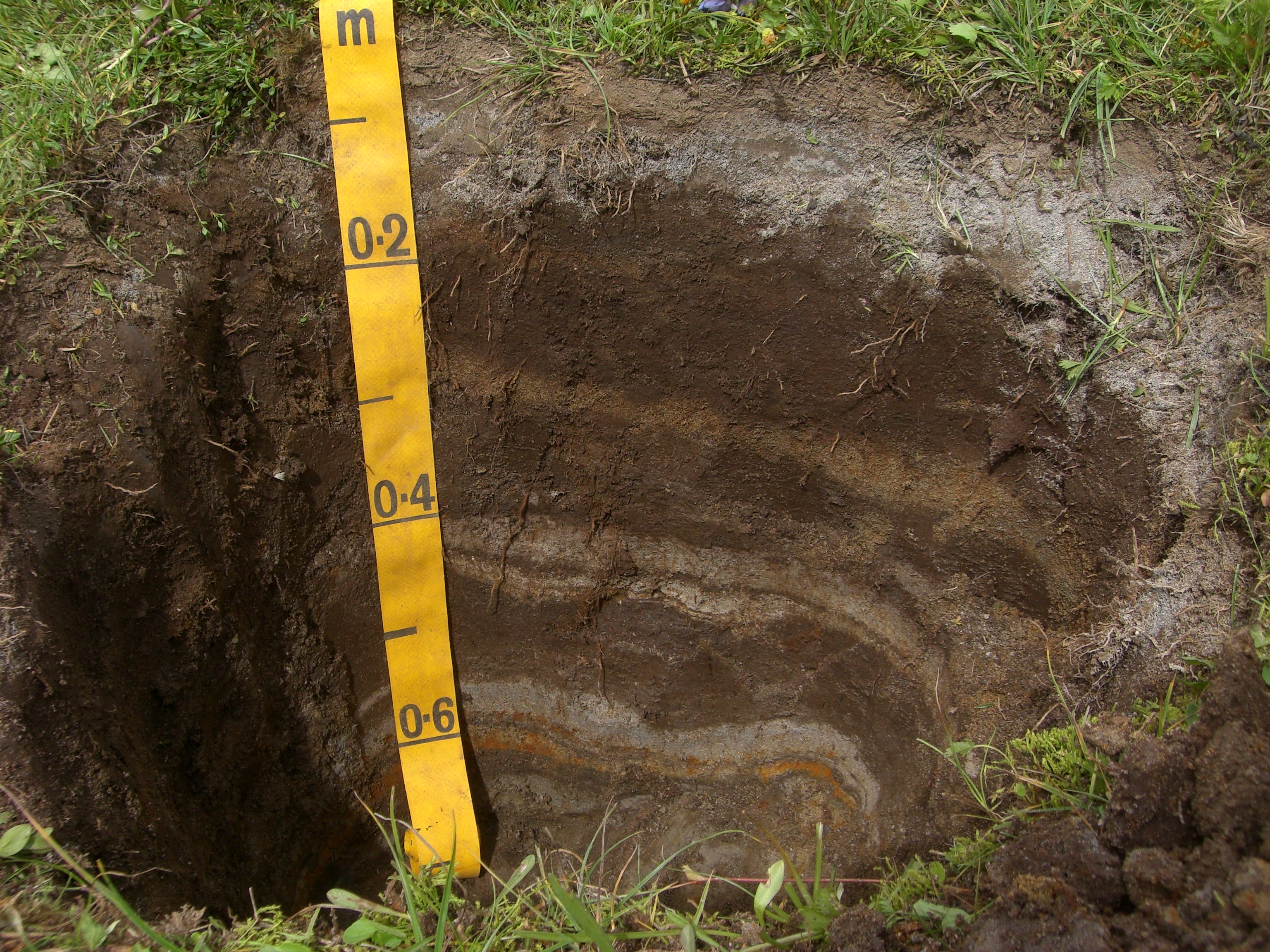
Some of the older moraines that have not eroded away are great places to dig soil pits on. This allows for the collection and age dating of soils, ash layers, and organics. The ages of morainal soils, ashes, and organics can be used to determine when the moraines were deposited and, thus, when the glaciers were at maximum extents. Looking closely at the soil pit below its possible to see many ash layers, probably originating from Mt. St. Helens eruptions.
Lab work
I will be spending the Fall of 2010 analyzing soils, plotting lichen measurements to lichen growth curves, using ArcGIS to illustrate surficially mapped geomorphic features, and researching and writing sections of the thesis.
Field assistance
I couldn't have completed my field work without the help of many wonderful people. Thank you Scott Burns, Rick McClure, Anna O'Coyne, Kevin Parine, Tim Schene, Matt Brunengo, Craig Heard, Trent Smith, Melissa McBride, Rob Schene, Adam Cockrill, Katie Heard, and Kent Stallings.