Master's Thesis Work of Robin R. Johnston
Department of Geology - Portland State University - Portland, Oregon
The National Science Foundation's (NSF) McMurdo Dry Valleys Long-Term Ecological Research (McMurdo LTER) project was established in Antarctica in 1992 to study the physical and biological constraints on the structure of ecosystems in the region. Andrew Fountain, with Portland State University, has been McMurdo LTER principle investigator responsible for studying the glaciers in the dry valleys. The dry valleys (location) are one of the coldest and driest regions on the planet, and the ecosystems in the valleys rely primarily on the meltwater from glaciers in the valleys. The climatic conditions of this cold desert offer a rare opportunity to investigate the development and progression of supraglacial channels on a polar glacier.
These glaciers are thermally defined as "cold" glaciers - that is, their internal temperatures are below the pressure melting point - and they lack the conduit systems that transport water internally which are typically found on temperate, or "warm" glaciers. Therefore, meltwater derived from the glaciers in the dry valleys comes from the glacier surface. On the lower ablation zone of Taylor Glacier, deep-cutting channels have developed on that surface. One of the primary goals of my thesis research is determining the evolution of these channels by studying ablation in the lower reaches of the glacier through modeling of the energy balance in the region of the glacier where the channels occur.
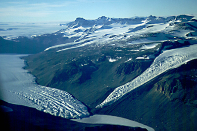
Deeply incised channels on the lower ablation area of Taylor Glacier (lower left) are visible in this 1999 aerial photograph (courtesy Dennis Kenley). Taylor Glaciers enters Taylor Valley from the East Antarctic Ice Sheet (background left). Ice-covered Lake Bonney, the proglacial lake at the snout of Taylor Glacier, is visible in the foreground. Rhone Glacier enters Taylor Valley from the Asgard Range (center right).
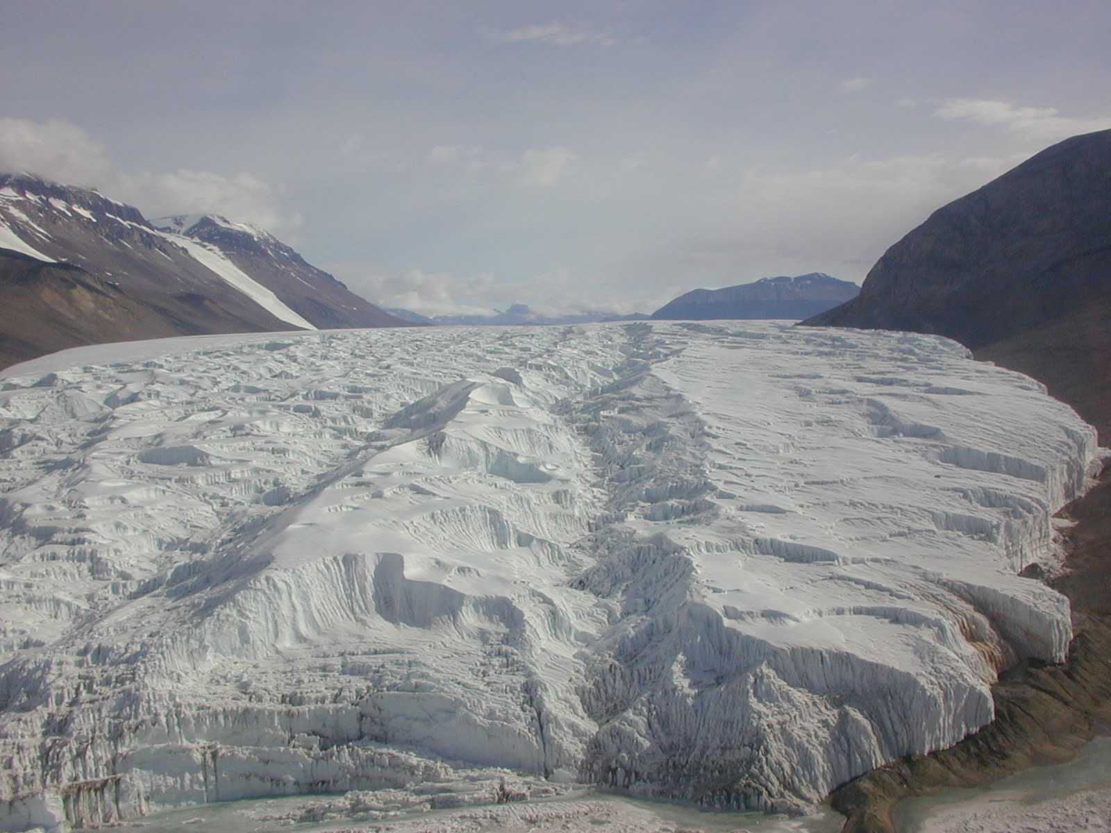
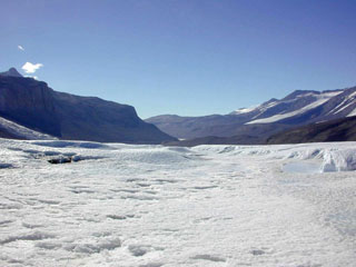
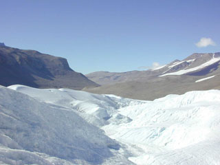
This is an oblique view from a helicopter looking up the channels on Taylor Glacier. For scale, the vertical terminus cliff in the right foreground and right of the image is roughly 20 m high. (Photo courtesy Thomas Nylen)
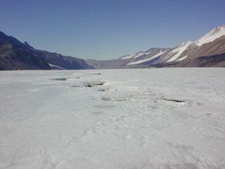
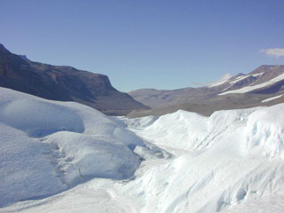
We believe that the morphology of these channels originates with changes in surface albedo caused by the deposition of rock material as medial moraines or wind-transported sand. The development of the channels probably depend on the energy distribution across the channel surface. The following images depict the evolution of one of the channels down glacier...
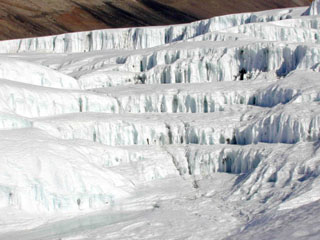
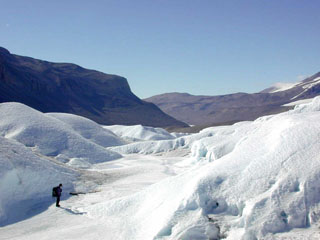
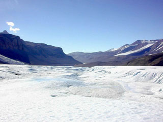
Up-glacier, the channel begins to form at the site of a medial moraine. It is relatively shallow and narrow at this point. (Photo courtesy Thomas Nylen)
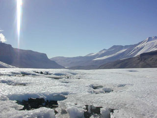
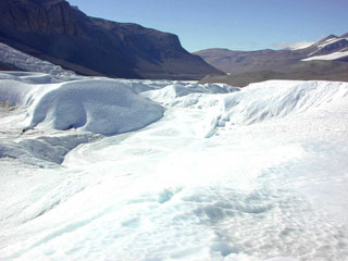
Down-glacier roughly 6 km, the channel has deepened and widened significantly. (Photo courtesy Thomas Nylen)
The following photo
series illustrates the progression of one channel. (Photos
courtesy Thomas Nylen)
|
Cross-section 02 |
Cross-section 03 |
Cross-section 04 |
Cross-section 05 |
Cross-section 08 |
Cross-section 09 |
Cross-section 10 |
Cross-section 11 |
Cross-section 12 |
Cross-section 13 |
Cross-section 14 |
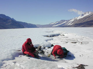
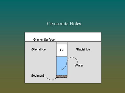
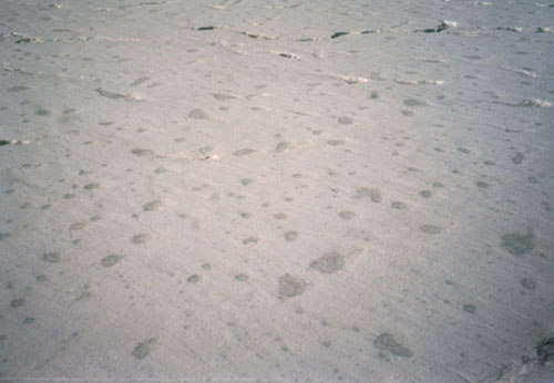
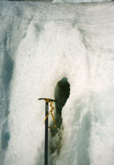
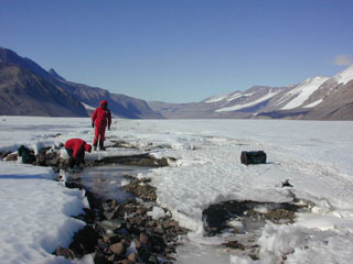
Cryoconite holes may also play an important role in the development of the channel, as discussed by Karen Lewis in her forthcoming dissertation. Cryoconite holes are cylindrical shaped holes in the glacier that begin to develop when wind-blown sand gets trapped in a slight depression on the glacier surface. This sand has a lower albedo than the surrounding ice and absorbs solar radiation differentially, thus melting in the glacier surface. The sediment continues melting into the ice, roughly normal to the glacier surface, until solar radiation can no longer reach it directly.
|
|
Sediment is then trapped in the base of the cryoconite hole and is covered by a column of liquid water. Over time an ice cap develops at the top of the cryoconite hole.
|
|
|
|
|
|
I am in the process of developing a model of channel enlargement with distance down glacier. More on this later...
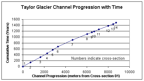
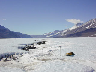
Survey data and ice velocities made it possible for me to estimate a cumulative time of roughly 1500 years for the progression of the channel from cross-section one to cross-section fourteen.
This web site is a work in progress and I will be updating it from time to time. Please feel free to contact me at robj@pdx.edu with questions or comments.
CHEERS