|
Glaciers of the Sierra Nevada
This page highlights my research on glacier change in the Sierra Nevada.
A publication and my thesis entitled "Quantifying Twentieth Century Glacier Change in the Sierra Nevada, California" are available:
Thesis (2008)
Publication (2011)
Numerous small alpine glaciers occupy the high elevation regions of the central
and southern Sierra Nevada, California. These glaciers change size in
response to variations in climate and are therefore important
indicators of climate change. While knowledge of glacier shrinkage in
the Sierra Nevada is common, there was little quantitative information
on the magnitude or rate of reduction. The purpose of my thesis was to define the number and spatial extent of the Sierra Nevada glacier
population, quantify the magnitude and rate of change in glacier extent for a small
subset of glacier, and compare the rates of change against climate variations.
|
|
Where do glaciers occur in the
Sierra Nevada?
|
|
|
Glaciers
are found high in the Sierra Nevada, generally above 10,000 feet in
elevation, on the north sides of steep mountains from Yosemite
National Park in the north to Sequoia National Park in the
south. Sierra Nevada glaciers are typically located in mountain
cirques, which are small bowl-like
depressions on the sides of mountains which were created by previous
glaciers.
The
number of glaciers in the Sierra Nevada depends on the definition.
The definition of a glacier is a body of perennial ice or snow that moves. Movement of ice
can be observed as cracks in the ice known as crevasses. Because Sierra Nevada
glaciers are small and remote previous glacier inventories
have placed the number between 50 and 500 glaciers. My
survey, based on USGS topographic maps (1:24,000 scale),
counted over 1700 glaciers and snow and ice patches. Many snow and ice bodies which
do meet the definition of a glacier. I estimated the number of "true glaciers" at 118
glaciers in the Sierra Nevada based on theoretical considerations.
|
|
 |
|
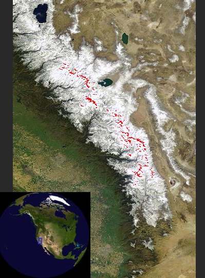
The central and
southern Sierra Nevada with glaciers highlighted in red to show modern
extent
(MODIS image) |
|
|
|
| How have glaciers changed over
the past century? |
|
|
Sierra
Nevada glaciers have become smaller over the past century. This is
evident from early photographs which reveal these glaciers occupying
their moraines around 1900. Today, the glaciers have receded up the
mountains and appear deflated. I quantified the surface area change by
selecting
fourteen glaciers throughout the Sierra Nevada and measured
the change using historical photographs, geologic evidence,
and field mapping. I determined the glaciers lost and average
of 55 percent of their surface area by 2004. The decrease in surface
area of individual glaciers ranged between 31 and 78 percent.
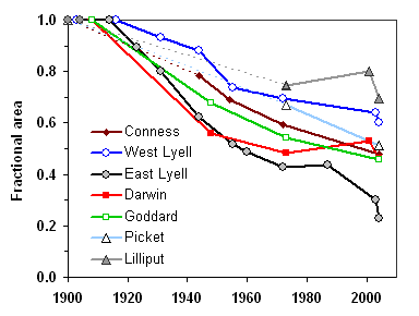
I selected
a subset of seven glaciers to determine the rate of change
over the past century. The results indicated that glaciers rapid
retreated occurred over the first half of the twentieth century
beginning in the 1920s in response to warm/dry conditions and continued
through
the mid-1970s. Recession ceased during the early 1980s, when some
glaciers
advanced. Since the 1980s each of the seven study glaciers resumed
retreat.
|
 |
|
|
|
Glacier Repeat
Photography
Comparisons
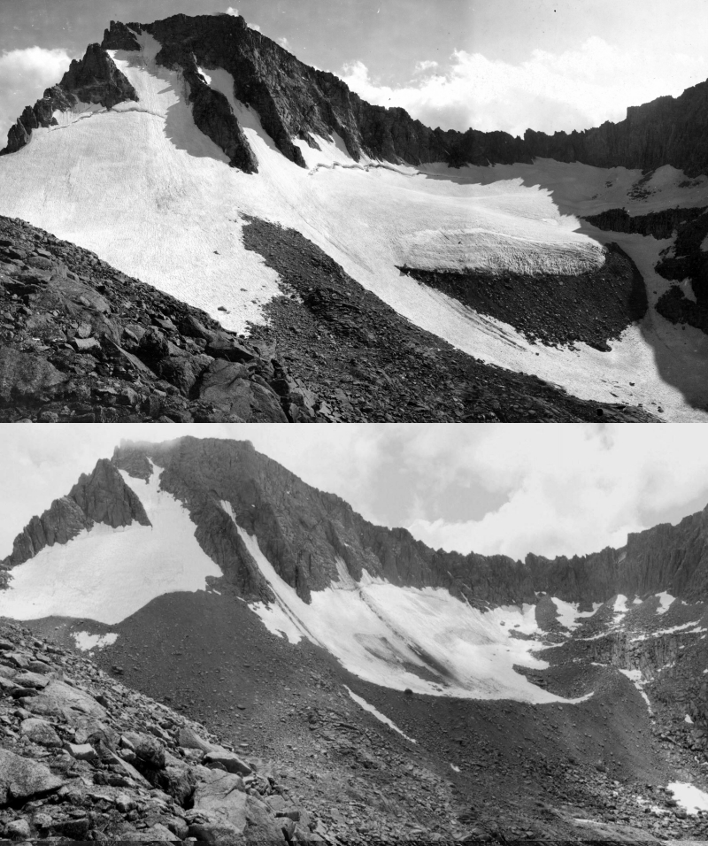
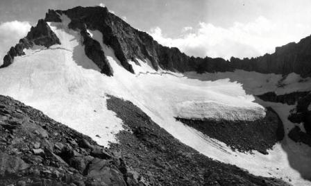
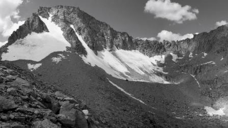
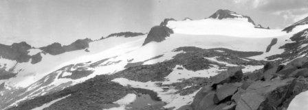
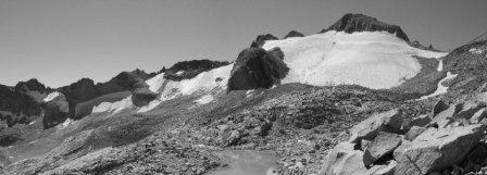
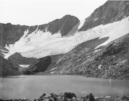
of the repeat photographs reveal that all ten glaciers surveyed in 2003
and 2004 have experienced a reduction in ice volume and surface extent
over the past century. Repeat photography is a valuable tool in
determining change through time, especially when combined with aerial
photos and field measurements.
Please
contact me if you are interested in using these photographs.
|
|
|
|
|
|
|
| Darwin Glacier |
 |
|
 |
|
August 14, 1908
G.K. Gilbert |
|
August 14, 2004
H. Basagic |
|
|
|
|
| Lyell Glacier |
 |
|
 |
|
August 7, 1903 G.K.
Gilbert |
|
August 14, 2003
H. Basagic |
|
|
|
|
| Dana Glacier |
 |
|
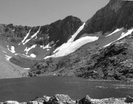 |
|
August, 1883 I.C.
Russell |
|
September 8, 2004
H.
Basagic |
|
|
|
|
|
|
|
| Sierra
Nevada Glacier Photographs |
|
|
Here
are some examples of glaciers in the Sierra Nevada from the Glaciers of the American West Photo Archive:
Maclure
Glacier
Palisade
Glacier
Darwin
Glacier
Dana
Glacier
If you are interested in more glacier photos visit our glacier photo archive. |
|
|
|
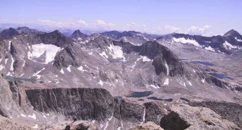
The view from Mount Darwin looking south toward Evolution Valley. Snow and ice remain in
north and northeast cirques that are protected from incoming solar radiation. (H. Basagic 2003) |
|
|
|
| Glacier Links |
|
130 Years of Glacier Change at Dana Glacier
- Updated 2013 repeat photographs from Dana Glacier |
|
Glaciers of the
American West
- Portland State University's glacier database. Includes interactive maps, historical photos, and reports. |
|
The Glacier RePhoto Project
- Repeat Photography in the American West |
|
Portland
State University Glacier Research Home |
|
Inventory of
Glaciers in the Sierra Nevada, California Raub,
W. B., Brown, C. S. and Post, A. 2006 US Geological Survey Open-File Report 2006-1239. |
|
|
| Links of Interest |
|
Altered
State: Climate Change in California - California Academy of Sciences Climate Change exhibit in Golden Gate Park, San
Francisco, CA |
|
Final Flight
- Peter Steckle's book on the 1942 plane crash at Mendel Glacier |
|
Glacier
Survey:
Embrodery and heat transfer work by artist Bonney Petersen, featuring
changes at Lyell Glacier, Yosemite. |
|
|
| Additional information |
|
POSTER:
Basagic H., Fountain A., Documenting Twentieth Century Glacier
Change with Repeat Photography in the Sierra Nevada, California (pdf) |
|
Questions
or comments? please contact me: basagic"AT"gmail.com
Created:
06/04/04; modified 07/19/14
Link
to Hassan's homepage
|
